Shade–Lohmann Bridge
This article needs to be updated. (July 2019) |
Shade–Lohmann Bridge | |
|---|---|
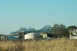
 Shade–Lohmann Bridge from the southeast | |
| Coordinates | 40°38′06″N 89°37′21″W / 40.635°N 89.6226°W |
| Carries | 4 lanes (2 each WB/EB) of |
| Crosses | Illinois River |
| Locale | Bartonville and Creve Coeur, Illinois |
| Maintained by | IDOT |
| ID number |
|
| Characteristics | |
| Design | Twin cantilever bridges |
| Total length | WB: 3,424.9 ft (1,043.9 m) EB: 3,420.9 ft (1,042.7 m)[1] |
| Width | 39.0 ft (11.9 m)[1] |
| Longest span | 541 ft (165 m) |
| Load limit | 60.5 short tons (54.9 t)[1] |
| History | |
| Construction start | 1973[2] |
| Construction end | 1975[1] |
| Opened | 1975[1] |
| Statistics | |
| Daily traffic | 36,700 (combined)[3] |
The Shade–Lohmann Bridge is a pair of twin cantilever bridges that carry Interstate 474 (I-474) and U.S. Route 24 (US 24) over the Illinois River near the Peoria Lock and Dam located at River Mile 158.0 in Tazewell County, in the U.S. state of Illinois. It connects Bartonville and Creve Coeur. Built in 1973,[2] the bridge was named after Pekin's former mayor and Illinois legislator J. Norman Shade, and Martin B. Lohmann, who served in the Illinois Legislature continuously from 1923 to 1953.[4]
On March 26, 2017, it was announced that the bridge would undergo reconstruction for steel repairs, electrical work, removing the sediment from bridge piers, and painting the bridge. The project cost $13.5 million.[5] Work started in April 2017 and was completed in November 2018.
References
[edit]- ^ a b c d e f "National Bridge Inventory Database Search - 2016". nationalbridges.com. Archived from the original on December 12, 2015. Retrieved September 29, 2019.
- ^ a b R.L. Polk and Company (1973). Polk's Peoria City Directory. R.L. Polk and Co. Publishers.[page needed]
- ^ Illinois Department of Transportation (2003). "Getting Around Illinois: Average Annual Daily Traffic". Archived from the original on February 19, 2007. Retrieved March 30, 2007.
- ^ Kravetz, Andy (June 26, 2015). "Extra: Peoria's bridges over the Illinois River have interesting origins". Peoria Journal Star. Retrieved September 29, 2023.
- ^ Erickson, Brad (March 26, 2017). "Bridge work in Peoria and Creve Coeur among major road projects". Peoria Journal Star. Retrieved September 29, 2023.
40°38′06″N 89°37′21″W / 40.63504°N 89.62260°W
- Bridges on the Interstate Highway System
- Buildings and structures in Peoria, Illinois
- Bridges over the Illinois River
- Bridges in Peoria County, Illinois
- Bridges in Tazewell County, Illinois
- Bridges completed in 1975
- Road bridges in Illinois
- Interstate 74
- Cantilever bridges in the United States
- Illinois bridge (structure) stubs
